Tackling The Back Way Into Guadalupe Mtns NP On Electric Power (Part 2)
Once the road finally finds its way out of the desert and onto the mountain range, a gradual climb begins. It’s still pretty rough here and there, with lots of ups and downs, but there are no more climbs so steep that the road needs a patch of pavement to survive the thunderstorms.
After a few minutes, the road finally reaches some views, but sadly not off the Guadalupe Rim’s 3,000-foot escarpment yet. Instead, you get views of the plains that stretch out to the east. My kids called the view ugly, and in some ways they’re right. This time of year (before the rains), the plains are a dull brown color. Looking north, you can see the south end of the Sacramento Mountains in the distance, though.

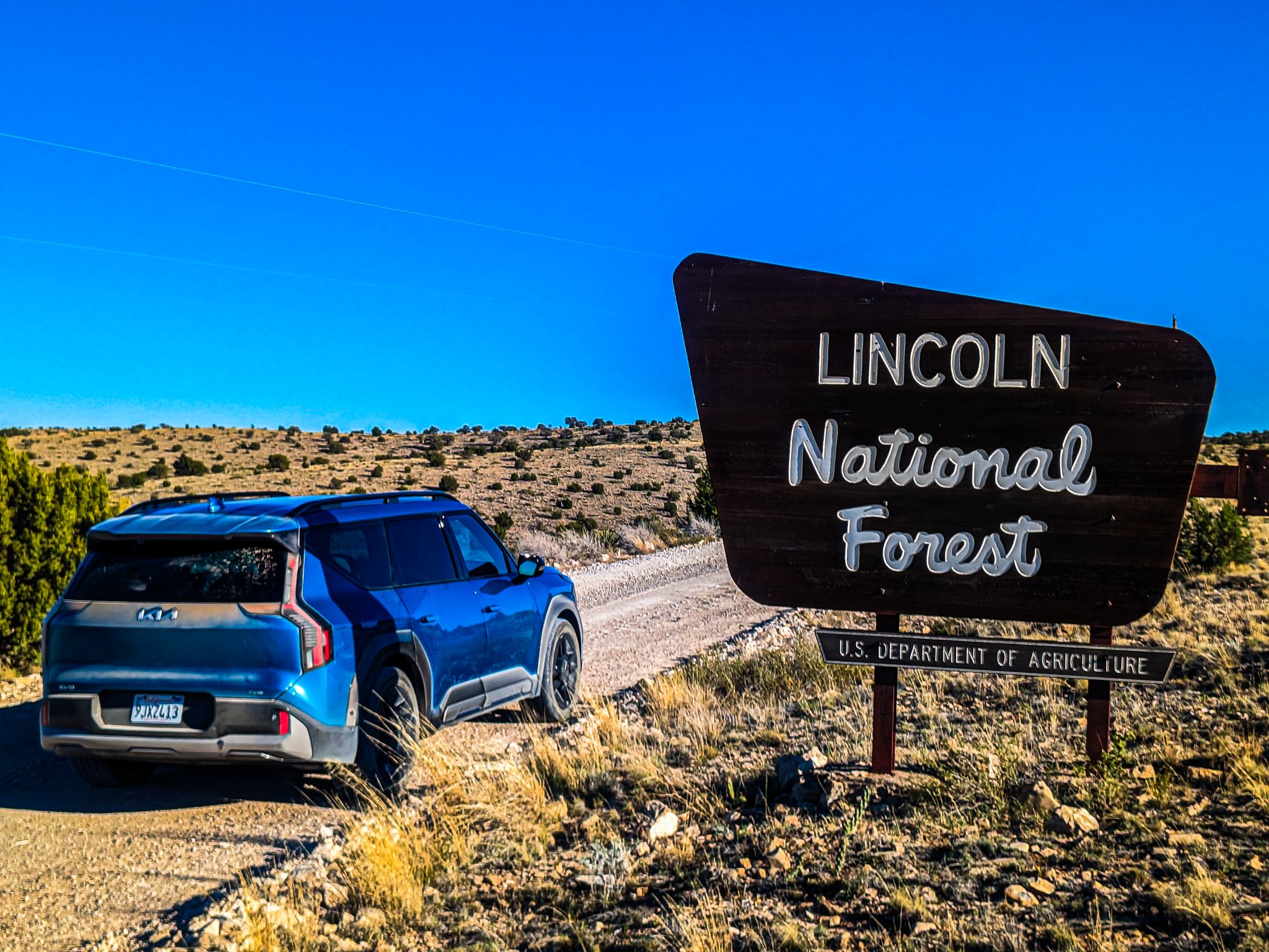
After a few miles of this, you forget that you’re headed toward the national forest lands, but the high desert begins to fade more and you start to see a few trees. At this point, you finally enter the Lincoln National Forest’s Guadalupe Ranger District.
Unlike the other ranger districts, the road never reaches the pines. As I mentioned in part 1, the Guadalupes just aren’t the kind of mountain range where you’ll find much water, and the desert heat doesn’t give much room for anything tall and magnificent to grow. But, the area does start to take on a beauty of its own, with layers of limestone emerging from the slowly greening landscape, the occasional cow, and more and more shrubs.
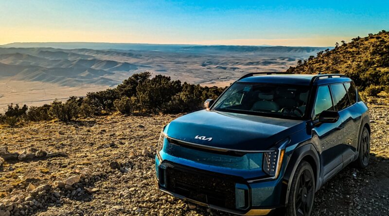
It’s only about 27 miles from pavement that the road finally comes up to the edge of the Guadalupe Rim, where the mountains suddenly drop off and give way to the expansive Otero Mesa. Far in the distance, you can see a great number of mountain ranges, including those of both the Sacramento and Smoky Bear ranger districts. The tallest mountain up to the north-northeast is Sierra Blanca, home to Ski Apache!

But stretching between us and those taller mountains was the rest of the Guadalupe Rim’s north section. Sadly, it was just too windy along the Rim to get my drone out and fly it without risking it being blown away (it’s good for maybe 20 MPH winds, maximum). This was a real shame, because 2D photographs from one spot and one elevation don’t really give you a true idea of the enormity of the view you get from that spot!
Here’s a video I found on YouTube from someone who showed up on a day with less wind:
After not very long, the road turns away from the Rim again, out of necessity. The land just gets a little too rough and full of ravines to be supportable. At this point, it started getting late in the day, and the views got darker. We passed cow after cow, but never saw another vehicle or human being along the entire stretch of road!
Well after dark, I started to reach the next set of Rim views. In the sunset light, I walked out to the edge to see what there was to see in the distance, and surprisingly found two mountain ranges that were a great distance away: the Organ Mountains near Las Cruces, and the Florida Mountains near Deming.

Sadly for flat earth believers, this image shows some proof of the curvature of the planet. If the 9,000′ peaks of the Organ Mountains are obscured by the ~5,000′ heights of the rim of the Otero Mesa between me and them, clearly there’s some dropoff happening!
After this point, things were just too dark to really see much. The road did give us some other sunset views, but the only noticeable thing was that the Piñon and Juniper shrubs were becoming a lot more tree-like in most areas.
One thing the family was starting to notice was the shrinking number in the battery’s state-of-charge reading. When we hit 20%, my regularly-scheduled Android Auto programming was interrupted by a big warning, so the EV9 made sure everyone in the vehicle knew it was hungry! This was a little concerning because software estimated that we’d have about 25% battery remaining when we reached our destination, and we still had another 20 or so miles to go. But, it’s hard for software to predict things like extra-steep hills in unusual places, gravel roads with patches of sharp rocks you have to move carefully over, and other power-consuming things.
Fortunately, I never go onto the back roads without some extra power planned at the end, and we still had plenty of energy stored to reach Queen. All in all, I drove 207 miles and had 10% battery left when I reached Queen RV Park, the next place where any kind of power was available. Using my own charging cord, I was able to plug into 50-amp service, but only pulled about 7 kilowatts (I don’t want to cause any problems pulling more than that). This was plenty of power to get a full charge overnight in the RV park’s cabins, where we were glad to get a good night’s sleep.
I considered taking the journey back the other way on the way home, but dozens of miles of rough ranch and forest roads had taken a toll on the family, and they wanted to head home on pavement when we were done visiting the national parks and other things in the area.
So, at some point in the future, I’ll need to take my Bolt EUV into the area. With far less range, I’ll definitely want to charge up in Alamogordo. I’ll also want to wait for the RV park to fix up some deferred maintenance issues they have with the cabins or bring my own RV along. Either way, I’m going to want to see more of the area on future trips!
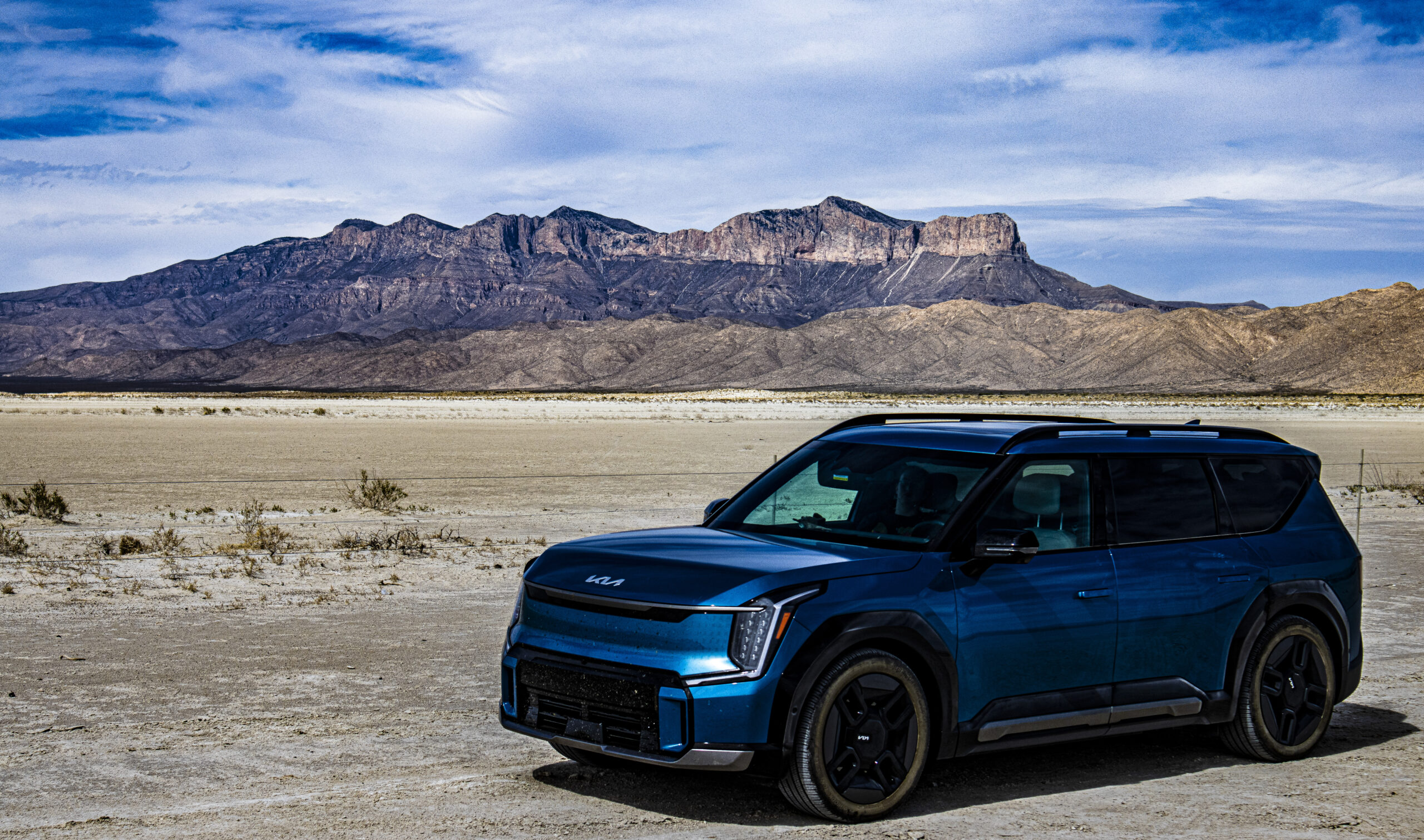
Despite not taking the scenic drive home, we still got to see some good scenery going home through El Paso along US-62/180. There’s no shortage of spots to appreciate the Guadalupe Mountains from the bottom near Salt Flats, for example.
Plus, there are some bonus views at a picnic area where you get to see the Cornudas Mountains (the tallest being Wind Mountain), but I’ll save photos of those areas for a future article.
All images by Jennifer Sensiba.
Have a tip for CleanTechnica? Want to advertise? Want to suggest a guest for our CleanTech Talk podcast? Contact us here.
Latest CleanTechnica.TV Video

CleanTechnica uses affiliate links. See our policy here.