
Tackling The Back Way Into Guadalupe Mtns NP On Electric Power (Part 1)
If you’re a regular reader, you’ve probably seen all sorts of photos of the EV9 I was reviewing last week. While I had it, I took it out on several adventures, visiting the Very Large Array, a sandstone canyon, and two national parks. Now, it’s time to tell one last story from my time with the car. I’ve partially covered this as part of two “how-to” articles on visiting Carlsbad Caverns and Guadalupe Mountains National Park, but I haven’t really told the tale of actually taking what is probably one of the most epic drives in the southwest.
But first, let’s talk a bit about where this road is and why it’s such a challenge for EVs. Once more EV drivers are familiar with the challenges and rewards, I think we’ll start seeing more people publishing trip logs in Rivians, Cybertrucks, and Lightnings through the area on their electric overlanding adventures!
The Guadalupe Rim Road
Almost everyone who has visited the Guadalupe Mountains has been to one or both of the area’s two national parks. The tallest parts of the mountain range are on the Texas side of the state line, all the way to the southwest of the range. Off to the east-northeast, the mountain range gets lower and lower, eventually becoming the desert mountains and canyons of Carlsbad Caverns National Park. The whole front end of the range was once part of a massive coral reef that was buried, fossilized, and then resurfaced to become the mountains.
But, that south end of the mountains is only a very small part of the area. The ridges of ancient reef go around in a rough circle, with exposed portions of the reef making up several other west Texas mountain ranges. Outside of that old circular reef (to the north of the official park) is the “back reef,” or areas that were flooded by muddy, high-salt water between the reef and the ancient shorelines. This lead to very different geology that’s very much visible when viewed from the north.
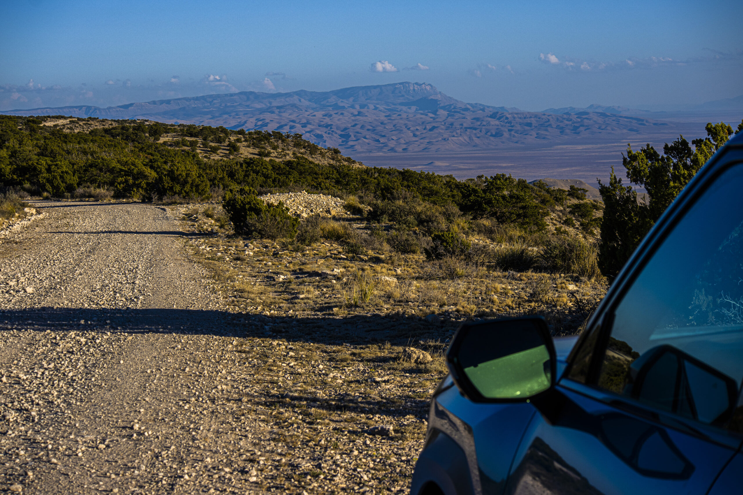
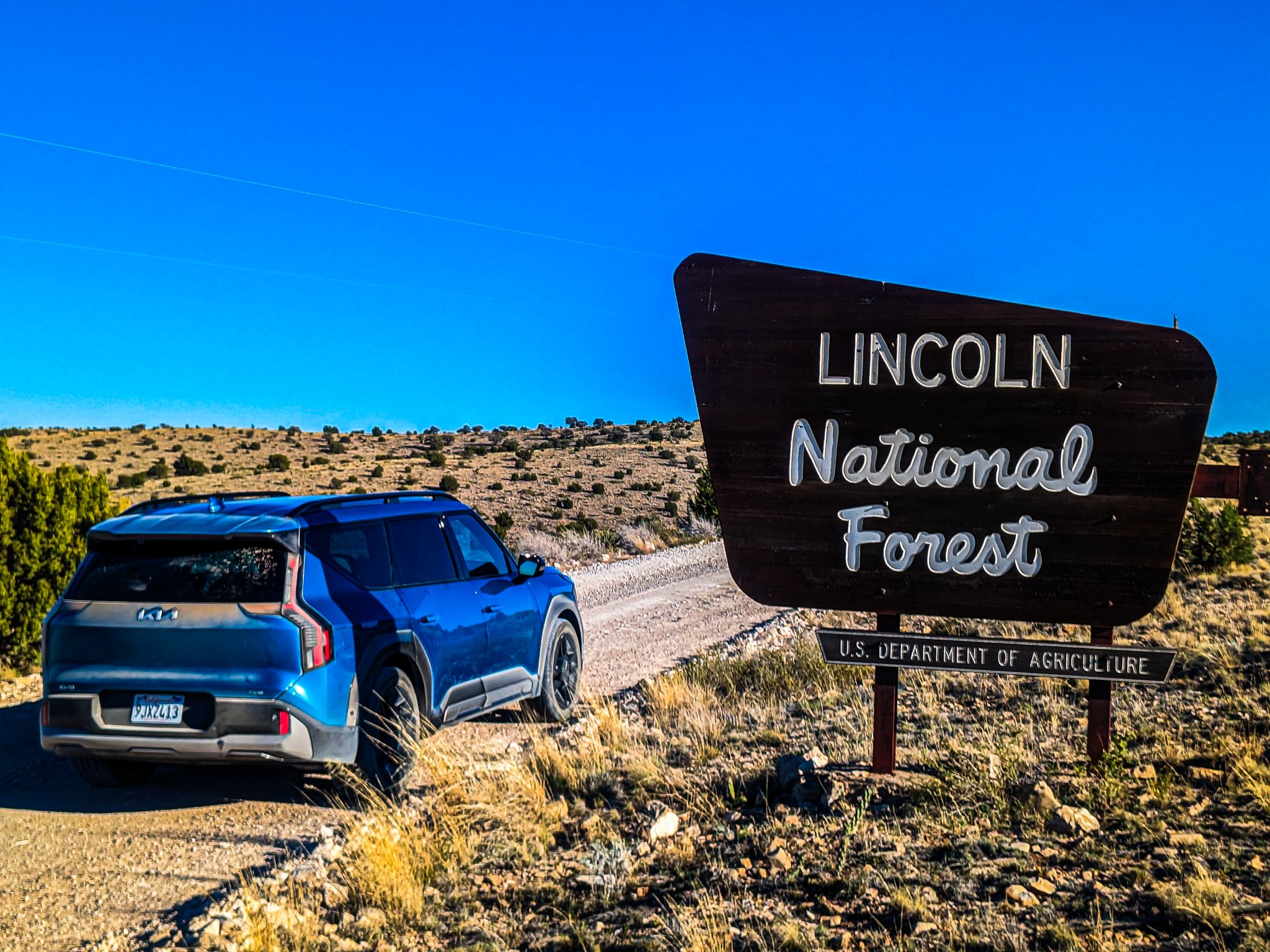
The same uplifting and stretching of the landscape that pushed parts of the reef up pushed up the rest of the northwest part of the mountain range, and pushed up ranges further to the north. All of these mountains in that chain are now the Lincoln National Forest, with the Guadalupe Mountains north of the state line being the Guadalupe Ranger District.

While people have lived in the back part of the Guadalupe Mountains for thousands of years, there’s one thing that really made it tough to inhabit: a lack of water. There are a few streams that tend to run a lot more in some seasons than others, but the geology of the limestone just isn’t terribly good for fostering the formation of springs and seeps. Unlike the other ranger districts further north the mountains just aren’t tall enough to promote significant snowfall, meaning there’s little snowpack, too.
To this day, there just isn’t much settlement in the area, with only ranchers living there and hunters, photographers, sightseers, and people riding ATVs visiting. Because there’s so few people living in the area and so few visiting it, there’s only one paved road (that goes to the back entrance to Guadalupe Mountains National Park) and almost no electrical infrastructure. This, in turns, means there’s no EV charging for most of the area, and it’s an area surrounded by oil country.
In other words, it’s a charging desert within a charging desert! The one thing that makes the road up the rim of the Guadalupe Mountains passable for EVs is an RV park in Queen, New Mexico, and charging in Alamogordo (L3) and Cloudcroft (L2).

My Trek From Cloudcroft to Queen
Due to an account issue I had and terribly customer support, I wasn’t able to use the Francis Energy charging station in Alamogordo, but I had left home in Las Cruces with a full charge in the EV9’s 98 kWh battery pack. By EPA standards, that’s good for around 270 miles in the GT’s AWD setup, but when you’re climbing from a 4,000-foot desert floor to 9000 feet in Cloudcroft, dropping back almost into the desert again, and then climbing back into the Guadalupe Mountains, you eat up a lot of battery. Add that all of the route after leaving the Piñon-Duncan highway is gravel, and energy consumptions is even higher. So, it’s not Kia’s fault that I didn’t get anywhere near that 270-mile figure.
After leaving Cloudcroft, the roads went from uphill to mostly downhill. I went down the twisty roads of NM-130 and then NM-24, all on decent pavement. After a brief uphill section before Weed (sorry, there’s no weed for sale in Weed), the highway then drops out of pine country and down into piñon-juniper country and then grasslands. At this point, the highway takes a turn east and starts to climb a canyon to get to the plains.
At this point, between Piñon and Duncan, there’s a little county road that leaves the pavement, heading south. This is where it begins to get interesting, because you figure out pretty quick that man hasn’t subdued nature very much in the area. The road follows the land, ping-ponging from ranchhouse to cattle pen to ranchhouse for a few, taking the paths of least resistance.
Fortunately, there are signs at every intersection telling you which way to go to get to the Rim Road from the county and ranch roads. For a while, it feels like the road is trying to find a way up and out of the high desert, going back and forth across patches of cactus and shrubland. But, eventually, the road finds a way out, and it’s not easy. In fact, the climb up onto the back side of the rim is so steep in two spots that they couldn’t make it a dirt road, because nature would destroy that road several times during the monsoon season.
So, in these two steepest spots, the county had to put in a small patch of pavement!
Featured image by Jennifer Sensiba.
Have a tip for CleanTechnica? Want to advertise? Want to suggest a guest for our CleanTech Talk podcast? Contact us here.
Latest CleanTechnica.TV Videos

CleanTechnica uses affiliate links. See our policy here.