When Champlain Towers South, a 12-story beachfront condominium in the Miami suburb of Surfside, partially collapsed on the night of June 24, it was a disaster that no one expected. But one team, at least, was prepared for it.
Since 2018, the National Science Foundation's Natural Hazards Reconnaissance Facility (known as the RAPID) has provided instrumentation, software, training, and support for research before, during, and after about 75 natural hazard and disaster events. Almost overnight, it can dispatch everything from iPads and cameras to a flock of sensor-packed drones or even a robotic hydrographic survey boat—as well as the expertise to use them.
In contrast to the public safety professionals who've deployed drones to determine the scope of the collapse and seek out survivors, the RAPID group looks for evidence of how and why buildings fall in the first place. And RAPID's mission is equally time-critical.
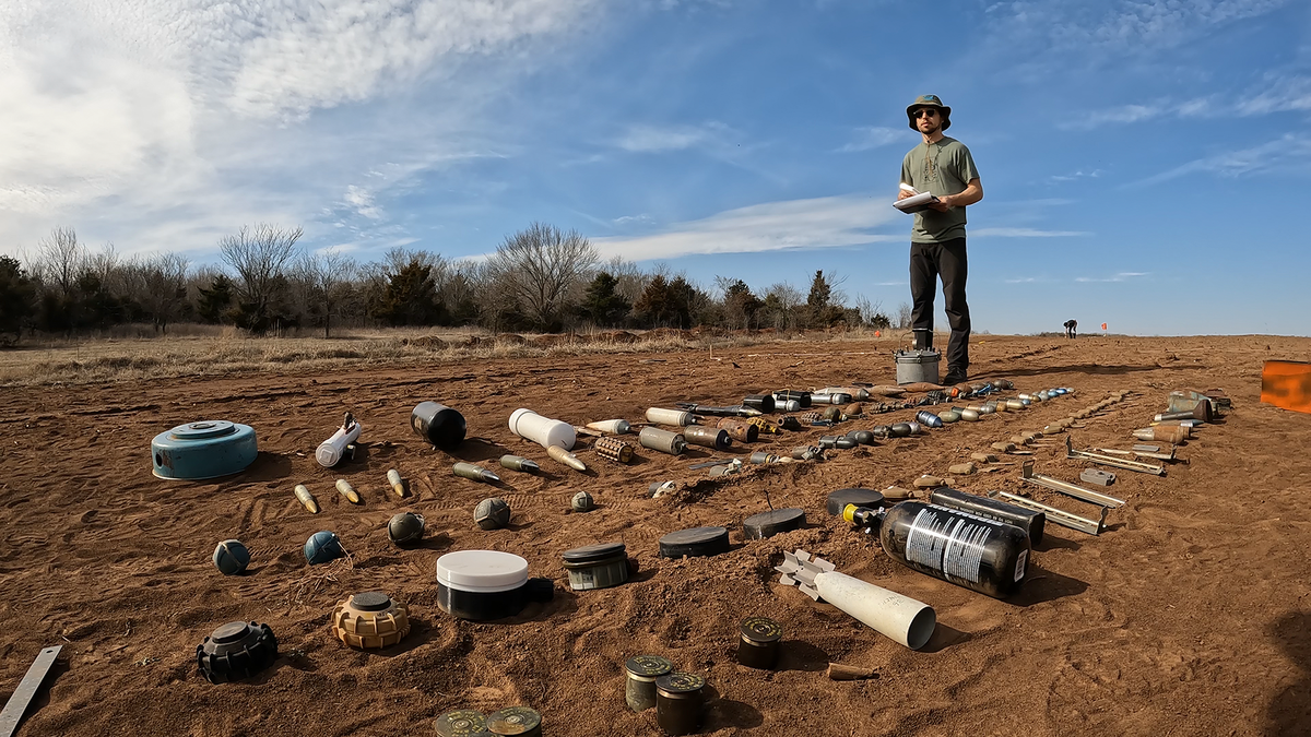
"We are set up to rapidly enter a disaster zone and very quickly collect the data before it's cleaned up as part of rescue and recovery," says RAPID director Joe Wartman, a professor of Civil and Environmental Engineering at the University of Washington in Seattle, where RAPID is based. "In a sense, we're the Navy SEALs of disaster data collection. We're the only facility in the world that does this work."
At least 98 people are now thought to have died in the Surfside disaster. Once its scale became clear, the RAPID team knew requests for assistance would quickly follow. "For major events like a big hurricane, we receive many more requests for RAPID than we can support," says Joy Pauschke, program director for the Natural Hazards Engineering Research Infrastructure (NHERI) facility, of which RAPID is a part. "It's up to us to go through and figure out which ones are addressing fundamental research questions, and to understand the situational awareness of accessing and operating at the location."
Within days, the National Institute of Standards and Technology (NIST) announced that it would be carrying out a full technical investigation of the tower's collapse—only its fifth such investigation since it was authorized to do so following the 9/11 attacks. NIST asked RAPID to deploy to Surfside to monitor a similar neighboring building to help it understand more about the structure that collapsed.
The team quickly gathered a lidar surveying system, drones, seismometers and accelerometers, and caught a red-eye flight to Miami. Even as they were in the air, however, everything changed. Tropical Storm Elsa was bearing down on the Florida coast, threatening the remaining structure. For the safety of rescuers and potential survivors alike, the stricken building would have to be fully demolished before the storm made landfall.
"By the time our team got on the ground, our mission had changed from simply monitoring, to trying to capture a full, three-dimensional digital model of the building before it was imploded the next day," says Wartman.
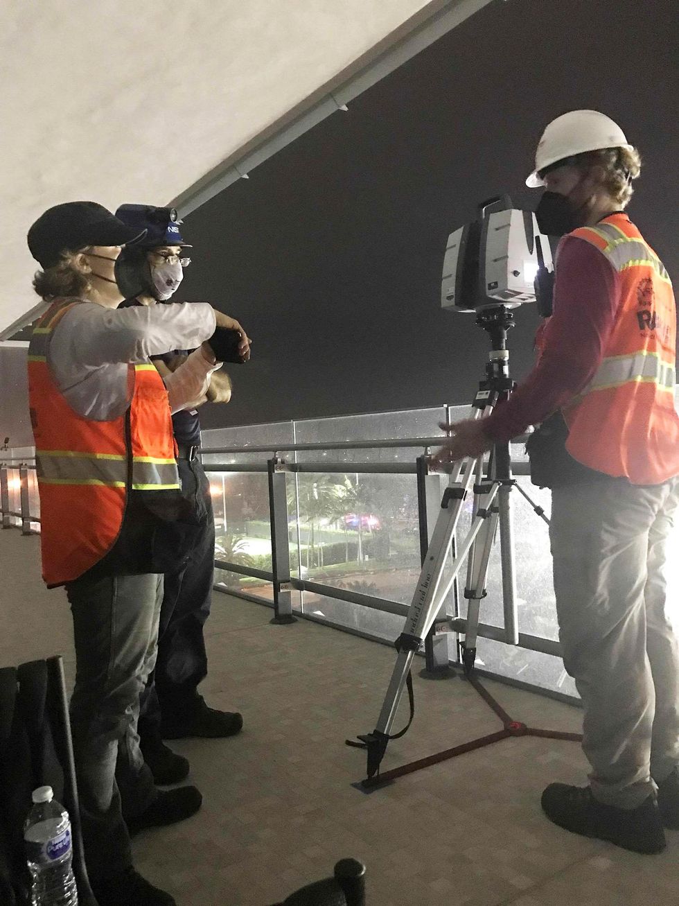 NIST and National Science Foundation staff members discuss imaging of the Champlain Towers South site using lidar, which uses pulsed laser light to measure distances to objects, creating a 3D representation of the site. NIST
RAPID team members went straight from the airport to the site, where they set up the lidar system amid unstable piles of rubble. "If we had two weeks to do this, we could have let the unit go for hours and scanned at the ultimate resolution," says Wartman. "But we were racing to capture all of this before the building came down, so we made the decision to do half-hour scans, giving just enough detail to get key structural components."
Working during the rescue teams' break times, RAPID engineers managed to complete seven scans detailed enough to measure the location and spacing of the building's metal rebar, the color and thickness of its concrete slabs, as well as trace individual cracks. The scans also recorded fallen columns and slabs nearby. Because lidar is an active sensor—rather a camera that passively records an image—the RAPID team could even work in low light.
After the structure was demolished on the evening of July 4, the RAPID team remained on site to scan the original debris pile. "The initially collapsed portion had a lot of information in it, in terms of the geometries of where things landed," says Jeff Berman, RAPID's Operations Director and also a UW engineering professor. "These were uncovered and documented as the rescue effort continued, layer by layer."
The RAPID team also flew a drone to collect image data, and instrumented Champlain Towers North, a near-twin of the collapsed building, with accelerometers and a seismometer. "These will measure incoming vibrations from heavy equipment on the excavation site and measure the building's vibration in response," says Berman. "The motivation is to inform the analysis of the south tower because its structural characteristics, natural period, and distribution of mass are likely to be similar."
After 10 days in Surfside, the RAPID engineers packed to return to Seattle—much lighter than when they arrived. With only three full-time staff, RAPID cannot stay at even a major disaster for long. "We can't go everywhere all the time," says Bergman. "So we left equipment with NIST staff who we had trained, and they were able to continue running scans until the excavation of the collapsed portion of building was at basement grade."
By this point, the RAPID team had stitched together its lidar and drone scans into a single, photo-realistic 3D model of the fallen building, and handed it over to NIST.
"What NIST is going to be spending its time on for the next year or two is trying to simulate the collapse to figure out what caused it," says Wartman. "They'll develop finite element models with a physics base, and use our 3D geometry to validate those models, to help understand where things landed and what portions did or didn't collapse."
The lidars and drones, meanwhile, have just arrived back at RAPID's Seattle HQ. They will now be cleaned, checked, recharged and put carefully back into their hard cases, ready to be dispatched again when the next unexpected disaster strikes.
- How NIST Learns from Horrific Disaster - IEEE Spectrum ›
- Why Robots Can't Be Counted On to Find Survivors in the Florida ... ›
- How Robots Helped Out After the Surfside Condo Collapse - IEEE ... ›